Water Quality Monitoring has been an integral component of the Ventura Countywide National Pollutant Discharge Elimination System (NPDES) Municipal Separate Storm Sewer System (MS4) permit (Permit) since the first Permit was issued in 1994. Previous permits have focused on Mass Emission, Receiving Water, and Land Use water quality monitoring. The current Permit (adopted in 2010) focuses on Mass Emission and Major Outfall water quality monitoring.
Mass Emission Monitoring
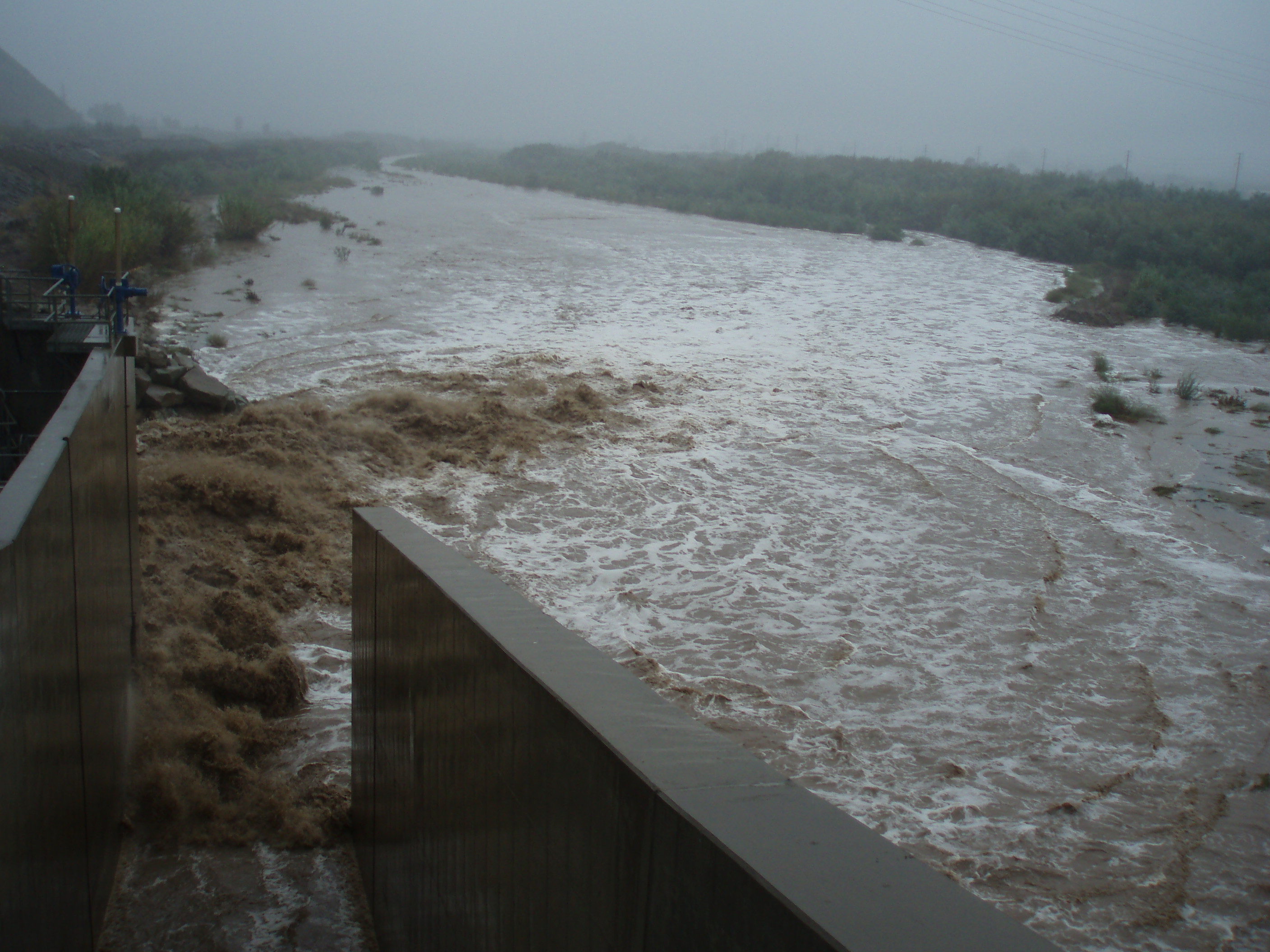
The purpose of mass emission monitoring is to identify pollutant loads to the ocean and identify long- term trends in pollutant concentrations in the receiving waters. Mass Emission sites are located in the lower reaches of the three major Ventura County watersheds: Calleguas Creek (ME-CC), Ventura River (ME-VR2), and Santa Clara River (ME-SCR). Mass Emission drainage areas are large and include multiple sources of discharge, including natural sources, wastewater treatment plants, municipal and agricultural sources, and groundwater discharges. Monitoring at these sites allows the Program to measure water quality parameter concentrations resulting from discharges throughout an entire watershed and evaluate the cumulative effects of stormwater and other surface water discharges on beneficial uses in the watershed prior to discharge to the ocean.
In accordance with the current NPDES permit, water quality samples are collected for chemistry, and bacteriological analysis from each Mass Emission site during three wet weather events including the first significant (>0.25”) storm during the wet season (October 1 – April 15) and one dry weather event during each monitoring year (July 1 – June 30). Aquatic toxicity samples are collected during the first significant storm of the season.
Monitoring at the ME-CC station was initiated during the 2000/01 monitoring season, monitoring at the ME-SCR station was initiated during the 2001/02 monitoring season, and monitoring at the newly installed ME-VR2 station was initiated during the 2004/05 monitoring season after landslide activity at the original Ventura River Mass Emission station, ME-VR (monitored 2000/01 - 2004/05 monitoring seasons) precluded further sampling at that location. Monitoring results and a map of the sites are included in the Annual Report, which is produced by December 15th each year. For more information or to obtain complete data packages, including data qualifiers and quality assurance/quality control information, please This email address is being protected from spambots. You need JavaScript enabled to view it..
Major Outfall Monitoring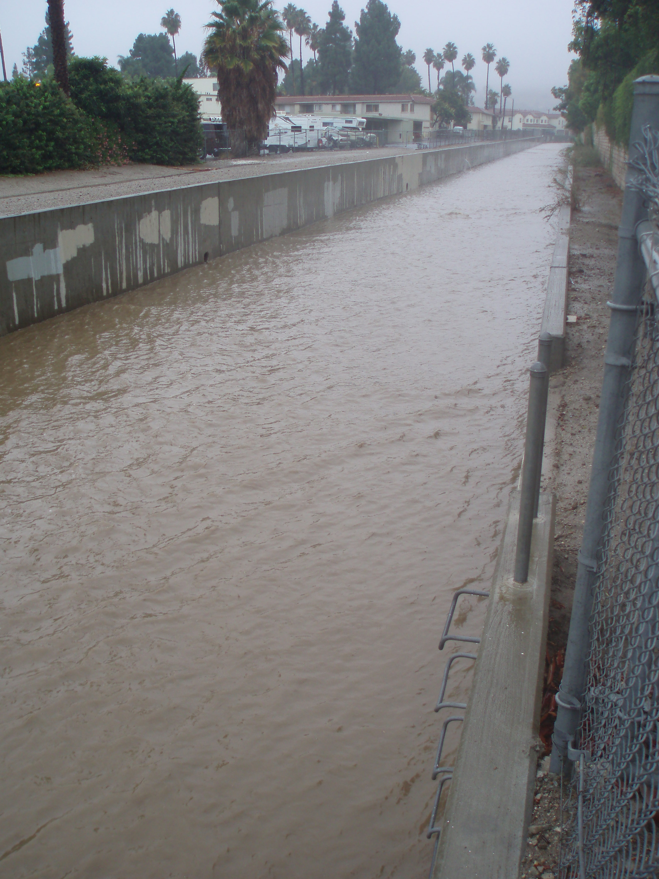
Major Outfall stations, a component of the Permit since 2009, are located in subwatersheds representative of each Co-Permittee’s jurisdiction, and are used to determine their contribution to downstream waters. Stations are located in the Cities of Camarillo (MO-CAM), Fillmore (MO-FIL), Moorpark (MO-MPK), Ojai (MO-OJA), Oxnard (MO-OXN), Port Hueneme (MO-HUE), Santa Paula (MO-SPA), Simi Valley (MO-SIM), Thousand Oaks (MO-THO), and Ventura (MO-VEN), and the County unincorporated area (MO-MEI in Meiners Oaks).
The monitoring requirements for Major Outfall stations are similar to those for the Mass Emission stations, as are the reasons for undertaking this monitoring. Comparing data from the Major Outfall monitoring with the Mass Emission monitoring can help determine if a municipal separate storm sewer system (MS4) is potentially contributing to exceedances of water quality objectives by comparing results to applicable water quality objectives in the Los Angeles Basin Plan and the California Toxics Rule (CTR). Over the course of many years, the data will be able to describe trends in waters from the Major Outfall stations over time. This information will be useful in evaluating the effectiveness of the Program and provide Permittees with real data on which to base future management decisions. Monitoring results and a map of the sites are included in the Annual Report, which is produced by December 15th each year. For more information or to obtain complete data packages, including data qualifiers and quality assurance/quality control information, please This email address is being protected from spambots. You need JavaScript enabled to view it..
Receiving Water (Tributaries) Monitoring
Receiving water monitoring was required in previous permits and was first implemented during the 1997-98 season and ended in the 2008/09 monitoring season. This type of monitoring evaluates the water quality of smaller waterbodies tributary to main river systems and allows a focus on smaller sub-basins of the watershed that are not impacted by discharges from wastewater treatment facilities. Monitoring a localized section of the watershed better examines the impact of stormwater on the watershed than mass emission monitoring (as discussed above). Monitoring data is available for the La Vista (W-3 map) and Revolon Slough (W-4 map) stations. Data is available in the archived Annual Reports or by This email address is being protected from spambots. You need JavaScript enabled to view it..
Land Use Site (Discharge Characterization) Monitoring
Land use monitoring was required in previous permits and was conducted from the 1992-93 monitoring season until the 2008/09 monitoring season. Land use monitoring is designed to capture stormwater discharge from a specific type of land use and was conducted under previous NPDES permits. The land use types included agricultural, industrial, and residential. Monitoring data is available for the agricultural monitoring site at Wood Road (A-1 map), industrial site at Ortega Street (I-2 map) and residential site at Swan Street (R-1 map). Data is available in the archived Annual Reports or by This email address is being protected from spambots. You need JavaScript enabled to view it..